Stand on busy Picton road at the bridge over Allens Creek, near Wilton NSW and you’ll get a picture of what a koala has to deal with to get to its feed trees. The relentless semi-trailer and car traffic barreling through this core koala habitat has resulted in at least twelve koala deaths over the past two years. But that’s nothing compared to what they’re facing when an anticipated 17,000-lot residential development engulfs this rural area.
The Department of Planning and Environment (DPE) has designated this as the Wilton Priority Growth Area under its Western City District Plan. Just 80km south west of the Sydney CBD, it’s part of the NSW government’s vote-winning solution to the city’s congestion and housing problem. But it’s coming at a high cost.
The Department of Office Environment and Heritage (OEH), the Rural Fire Service (RFS), an independent scientist and the local Wollondilly Council have all weighed in against the existing proposal, saying it goes against long-standing scientific advice and ignores State planning laws. It also threatens the survival of the largest chlamydia-free koala population in NSW.
The DPE’s developer, the Sydney-based Walker Corporation has twice been successfully prosecuted for having illegally cleared areas of sensitive koala habitat, earning them the largest such fine in NSW history. That’s just one of a raft of irregularities that have plagued this controversial project.

Glenn the koala is drugged to the eyeballs on painkillers as he is cared for by Wires before pending surgery. Glenn was hit by a car and had his jaw broken. Photography by Dean Sewell/Oculi.
Wollondilly Shire Council has lodged an appeal against the DPE in the Land and Environment Court, saying that the rezoning of land in the Wilton South East Precinct ignores scientific advice from the OEH.
Judith Hannan, the Wollondilly Shire Mayor, says Council is not against the development at Wilton. “We’re asking for the reversal of the rezoning, until we get a solid conservation plan sorted out. We feel like there’s a tidal wave coming at us and the koalas are sitting in the path of it.”
Hannan says that long term planning has been inadequate for such a large-scale development and there are insufficient jobs and infrastructure to support it. “There is no reliable public transport to the area, no provision for employment, no integrated health service. How many other things would you like? It’s a nightmare and we don’t have much ability to stop it.”
She says that the koala road-kill problem is at crisis-point. “Even during the last council meeting, someone sent us a live photo of a koala in Appin in the service station and that evening that koala was dead on the road. It was horrendous.”
Councillor Matthew Deeth goes a step further.
“It beggars belief how the planning department makes these decisions. There’s no transparency at all and there’s no response to any of the concerns that council has raised,” he says. “I can’t point to any letters or anything to show they’ve even considered any of our concerns.”
Council’s environmental education officer, Damion Stirling has been at the coal-face of this issue.
“What triggered this for us was the southeast Wilton rezoning (from rural to residential),” he says. “We weren’t informed (by DPE) when that rezoning dropped, we found out through social media. They’ve (DPE) made reference that council had been consulted, but any submissions made were not adopted.
“They even reference measures to minimizing the impact on koalas, but they’re words on the page and we haven’t seen that detail.”
Stirling showed me the roadkill hotspot at Allen’s Creek, in the southeast tip of the proposed development. He says the creek constitutes part of an east-west running corridor that is vital to the survival of these koalas.
This was identified as far back as 2005 as a likely primary koala corridor by Professor Rob Close of the University of Western Sydney, with sightings going back into the Nineties.
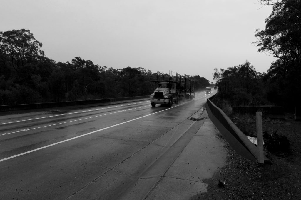
Trucks ramble over Allens’s Creek on Picton Road, the Wilton Koala corridor. Photography by Dean Sewell/Oculi.
The Wilton area was officially recognised as a primary koala corridor in 2007, by the Department of Environment, Climate Change and Water (DECCW), the precursor of the OEH. An OEH spokesperson has confirmed that core koala habitat and primary movement corridors have been identified within this region.
In mid-2016 a pilot study between Appin and Wilton found eight koalas in a week. That was enough information for OEH to fund the Wilton Koala Conservation Project, granted $200,000 from the Saving Our Species fund – the second highest funded project in the state. It’s tracked koalas through the area, specifically along Allen’s Creek, which features a good selection of koala feed trees.
Cate Ryan, a long-time WIRES carer, knows the inevitability of koalas seeking food or mates in the vicinity of Picton Road.
“They’re trying to disperse to other areas and they’re becoming roadkill. The issue with all the koalas is if they become landlocked they’ve got no escape. There’s no feed for them, so they’re coming out onto the roads and they’re getting killed. If they’ve got no underpasses or overpasses they can’t get to other breeding stock, so they become genetically compromised, because they start inbreeding. We’ve already noticed some conditions – smaller koalas, smaller eyes and irregular eye shapes.
“There’s no food out there and what’s up here is dying because of the drought. It’s horrible. I’d hate to be a koala.”
Ryan says the biggest fear is that chlamydia-infected koalas from colonies to the south may move towards Wilton for the same reasons, compromising the health of the local koalas.
“Because these guys here are disease free, they could be used in breeding programs as stock to repopulate areas where they’ve been decimated by disease. There’s a whole lot of things we can look at for the future with these guys, but unless they’re protected, there’s nothing.”
Underneath the highway bridge at Allen’s Creek, Stirling points out a huge culvert that would provide safe access for wandering males and breeding females with back-young, searching for the increasingly rare food trees they need to survive.
“It’s one thing to protect koalas from road kill, but we need to be feeding them into quality habitat corridors that will enable their dispersal,” he said.
“This creek line corridor links all the way down to the Nepean on the other side of Douglas Park. At the northern end of it is the St Mary’s Towers biobank site. There’s breeding females with back-young on there as we speak, identified by OE&H.”
Stirling observes how easily this infrastructure could be adapted to a koala corridor. “Down here you can see the scats and footprints of kangaroos and stuff, so it’s already being used by fauna.
“From Roads and Maritime Services’s point of view, this is an easy win. Even that concrete barrier on the bridge up there is enough to stop a koala trying to cross the road.”
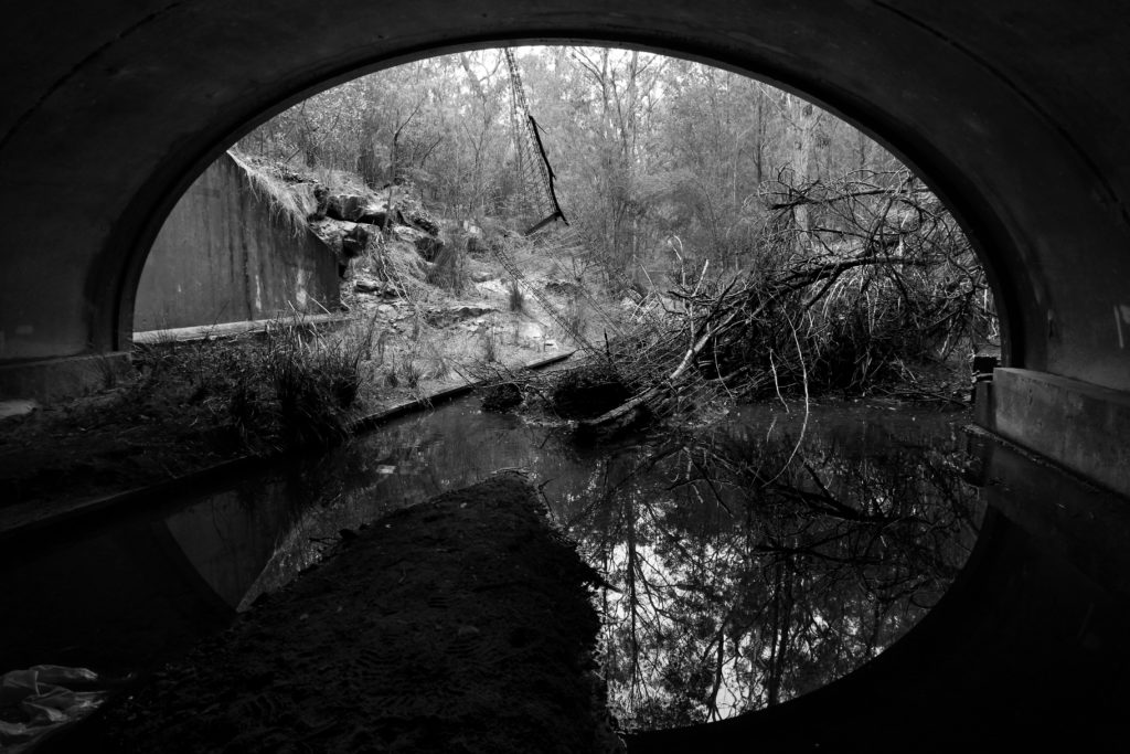
Allen’ s Creek runs under Picton Road where koalas are still able to move between their breeding/feeding grounds. Photography by Dean Sewell/Oculi.
But the development planned by DPE favours a corridor bisecting 23 hectares of land, illegally cleared by the Walker Corporation in 2005. According to Land and Environment Court transcripts they were fined $200,000 for that transgression, at that time one of the largest fines for illegal clearing of vegetation in NSW.
In 2011 Walker were fined an additional $80,000 for illegal clearing at Appin, where their current rezoning proposal is.
Court transcripts indicate that DPE used the same land clearing contractor for both jobs and that the contractor understood the clearing was in anticipation of a future land rezoning – six years before the DPE’s exhibition period in 2017.
Councillor Deeth points out that Walker Corporation’s proposed corridor leads into the Nepean Conservation Area, whose sandstone soils do not support koala feed trees. He says Council is privy to the process followed by OEH, who warned against the DPE proposal.
“They gave advice to the DPE that the Allen’s Creek corridor was the best option for the koalas. The DPE has ignored their advice and instead hired an outside team of consultants to give them another result, an act which I believe is unprecedented in this field. The OEH is supposed to provide the environmental data and advice to the DPE, to be incorporated into the overall planning. But the OEH has been reduced from a department in its own right to an office advising the DPE and even this status appears to have been sidelined.”
The DPE not only ignored their own environmental office’s advice, but appear to be flouting State Environmental Planning Proposal 44 (SEPP 44). Under that law the DPE is obliged to do a site-specific koala plan and the rezoning of the land should not have happened until a biocertification and vegetation mapping process had been completed.
The reason this has not been completed involves a Kafka-esque bureaucratic turn that belongs in the realm of fiction.
When the state government’s new Biodiversity Act came into force on 24 August last year, Wollondilly Council received a phone call from DPE, telling them its growth area was exempt from the Act for a further 12 months – until the biocertification process was completed.
“We were told the biocertification process would be completed by Feb 2018, then it was June, but it still hasn’t been completed,” said Stirling. “We’ve now been told that the Act won’t come into force until November, 18 months later.”
While the DPE’s rezoning ignores SEPP 44, it also sidelines advice from the Rural Fire Service that the bushland southeast of the proposed development is a major fire risk and would require an exit road bisecting the DPE’s proposed koala corridor.
If the reader were to fancy that the DPE has not been taking this process seriously, they should consider that in January 2018, Wollondilly Council received a draft Development Control Plan (DCP) from DPE. Rather than sending a new document, specifically designed to reflect the area’s ecological sensitivities, they instead sent a tracked changes version of Blacktown Growth Area’s DCP. On the last page was a single picture and two sentences about koalas.
Apart from this slapdash approach, Stirling claims DPE’s process ignores four key recommendations of the NSW chief scientist’s 2016 report – a crucial direction being that the proponents of development must act on evidence.
Indeed, Stirling observes that when he recently looked for submissions over the Wilton Southeast zoning on the DPE website, he discovered that the only documents listed were the developer’s submissions.
“So Council are now GIPAA-ing (Government Information Public Access Act) for those reports and all other submissions around koala habitat that were part of this rezoning.”
Stirling says that even the week before the rezoning, he’d been at a round table meeting called by the DPE to discuss conserving koalas in the region.
“There was no mention that the land around Allen’s Creek was going to be rezoned the following week.”
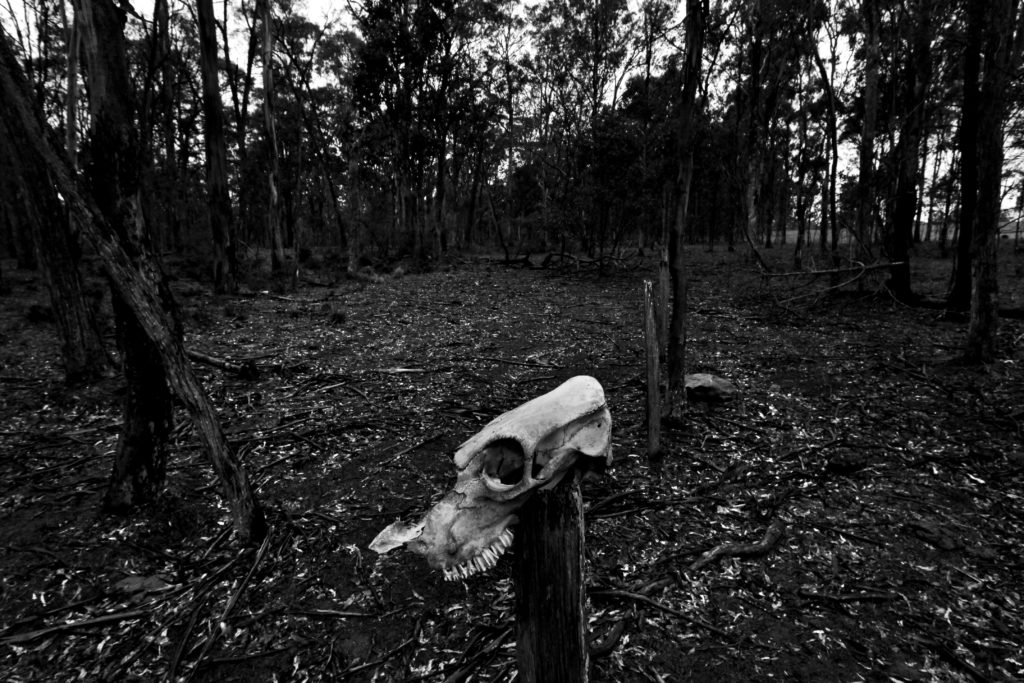
Previous land clearing is still visible. The Walker Corporation development group copped the largest fine in Australian history for illegal land clearing. Photography by Dean Sewell/Oculi.
Stirling has a lot of unanswered questions for the DPE.
“We’re questioning how can this rezoning go through before the biocertification process is complete, and without being assessed under the biodiversity conservation act?
“Why have the DPE proceeded in rezoning this land before that work is finished, on such a significant project?
“Why was that project not profiled in the NSW Koala Strategy, considering it was one of the largest koala funded projects in the state?”
“We’re saying the DPE plan is not appropriate,” he concludes. “It doesn’t even consider that koalas move through the canopies of trees. How are they going to fence the middle of that bushland there to stop the koalas?
“We have to work out what the transition is between protected koala habitat and urban areas. We’ve already got a number of threats – eight koalas killed in eight weeks on Appin Rd, last year 14 koalas killed in two months, so that’s the major threat at the moment. The next threat is development wiping out habitat, then dog attack, fires, weed invasion, so we’re trying to get ahead of the game and say, ok we know where the habitat is, let’s protect it now. We have the knowledge to do best practice, let’s do it, let’s find a balance between conservation and development for housing.”
Councillor Deeth, too, has searching questions.
“I understand that OEH scientists were being pressured from above to tone down their reports to the DPE,” he said.
“Council had an extraordinary meeting a couple of months ago. Our resolution was to GIPAA the government to get the exact communications, exactly what advice was given and what was the response from the DPE around that issue. My understanding was there was real pressure coming from much higher up the chain and we want to understand how their decisions were made.
“Housing at all costs seems to be the department of planning’s motto at the moment. We don’t even know what sort of density we’re looking at within these zones. All we’re suggesting is we want a pause to get this right. There’s nothing wrong with taking a bit more time to actually get it right. You can see from every provision there’s a heap of unresolved issues.
“We have no idea why the Walker zones were rammed though with so many unresolved issues. They’re happy to pay the fines because in the grand scheme of things it’s a pittance.
“We have very little say in this whatsoever. The only thing we’ve got left is advocacy and letting people know what we’re not happy about.”
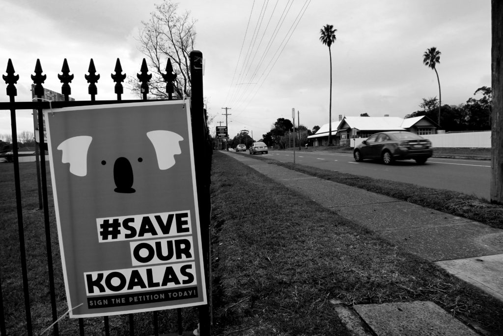
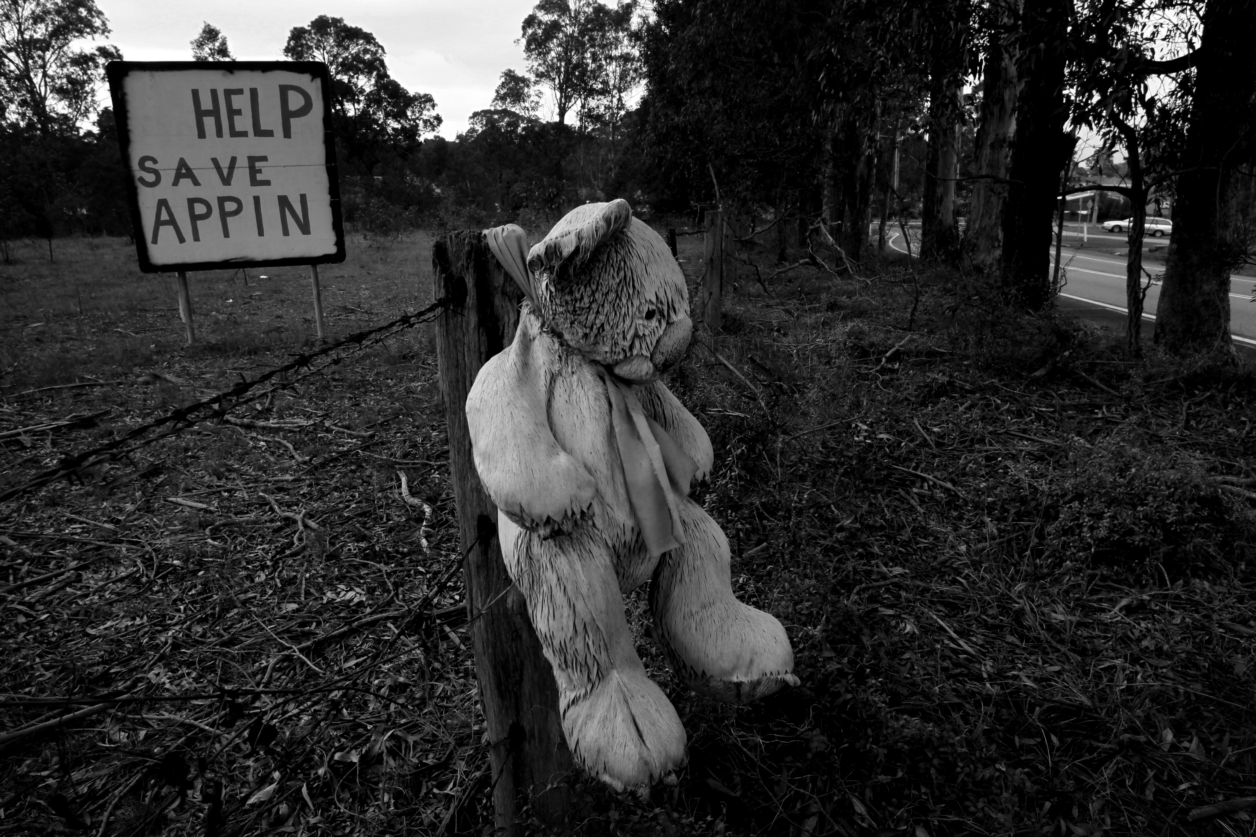
Signage for a petition on Appin Road, Appin. Photography by Dean Sewell/Oculi.